By 1812Blockhouse
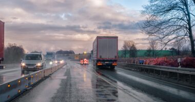
On a summer afternoon north of Lexington, a narrow band of storms forms over the hills. Radar shows “possible rain,” but the wind in the field tells a different story. A sudden gust pushes across the soybeans just as a grower considers spraying. One wrong call means wasted product, lost time, or worse, off-target drift into a neighbor’s crop.
It’s the kind of guesswork farmers in Richland County deal with more often than they should.
The new Ohio Mesonet wants to take the guesswork out of it.
Finally, Weather Measured Where It Actually Happens
The Ohio Mesonet is a statewide network of research-grade weather stations led by the State Climate Office of Ohio and the College of Food, Agricultural, and Environmental Sciences at Ohio State. These aren’t airport instruments or satellite estimates. They sit in real fields on real working land.
Richland County is in a tricky position. Our hills influence wind and rain patterns. Storms coming across the Clear Fork Valley can look harmless on radar, then intensify suddenly as they hit warmer ground near Ontario or farmland west of Shelby. Radar doesn’t see that shift. A Mesonet station can.
“Weather remains the single most influential factor in crop yield, yet parts of Ohio still lack adequate weather monitoring,” said Aaron Wilson, Extension field specialist in ag weather and climate and leader of the network. “That lack of information introduces risk — and in farming, risk is everything.”
What Makes a Mesonet Station Different
Every station captures real-time readings that matter at field level:
• Air temperature
• Soil temperature and moisture at multiple depths
• Wind speed and gusts where crops are growing
• Rainfall totals as they fall, not hours later
• Humidity and solar radiation
Some stations include leaf wetness sensors and equipment that detects temperature inversions — a major factor in determining spray safety. Radar can’t show you that. A smartphone app can’t either.
With Mesonet data, a grower can know at that moment whether spraying is safe or if chemicals could drift across a fencerow.
Richland County’s Advantage
The first round of Mesonet stations is rolling out across the state, and Richland County is on the list for expanded coverage as the network grows. Local agriculture stands to gain — especially in areas around Shiloh, Butler, Bellville and other places where farms and hills meet unpredictable microclimates.
Better data also matters to emergency crews. Heavy rain along the Rocky Fork can create fast-moving water in low spots. A few minutes of earlier warning can change how responders act and where resources are placed.
From Field Insight to Public Safety
Farmers will use Mesonet data to:
• Plan planting and harvest windows
• Limit fertilizer and spray loss
• Protect crops from heat or disease stress
• Avoid compaction by checking soil moisture down in the root zone
But the network’s value doesn’t stop at farm fields.
“These observations could lead to more accurate and earlier warnings for severe weather events — saving property, income and potentially lives,” Wilson said.
The network grew from an initial donation from weatherUSA, matched by CFAES, and now includes support from the Ohio Soybean Council, Nationwide and the Ohio Farm Bureau. The goal: a station in every Ohio county.
Weather, Ground-Truth Real
Richland County residents know this already: Mansfield weather is not Shelby weather. Lexington is not Bellville. And what happens at the airport doesn’t always match what’s happening along a rural ridge line.
The Ohio Mesonet brings weather down to the field — and, finally, down to the places where decisions are made.
No more hoping the radar is right. Now we’ll know what’s happening in real time, right here at home.
For the first time, we’re seeing what the sky is doing right here.